


cravant vézelay

bruno38
User
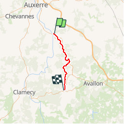

Length
34 km

Max alt
296 m

Uphill gradient
879 m
Km-Effort
45 km

Min alt
108 m

Downhill gradient
707 m
Boucle
No
Creation date :
2019-01-15 16:42:33.944
Updated on :
2019-01-15 16:42:33.944
10m
Difficulty : Unknown

FREE GPS app for hiking
 SityTrail
IGN / Geographical institutes
SityTrail Plus
The world is yours!
About
Trail Other activity of 34 km to be discovered at Bourgogne-Franche-Comté, Yonne, Deux Rivières. This trail is proposed by bruno38.
Description
2eme jour de auxerre vézelay
Positioning
Country:
France
Region :
Bourgogne-Franche-Comté
Department/Province :
Yonne
Municipality :
Deux Rivières
Location:
Unknown
Start:(Dec)
Start:(UTM)
551854 ; 5281394 (31T) N.
Comments